
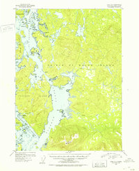
1951 Map of Craig D-4
USGS Topo · Published 1953About this map
Prince of Wales Island is documented here during the early 1950s, revealing a coastline defined by intricate waterways like El Capitan Passage and Tuxekan Passage. The mapping highlights a transition in human settlement, specifically identifying Deweyville (Aban'd) and Tuxekan (Aban'd) as abandoned sites, offering a window into the shifting demographics of the Tongass National Forest. On the western edge, Tokeen remains a focal point among the smaller islands.
Find a feature on this map
54 named features on this map. Tap any name to fly to it.
Don’t see what you’re looking for? This feature index may not catch every label — zoom into the map to look around manually.
Map Details
Editions of this 1951 Craig D-4 Map
2 editions found
Other maps of this area

1949 · Craig D-3
USGS Topo · 1:63,360

1949 · Petersburg A-3
USGS Topo · 1:63,360

1949 · Craig D-4
USGS Topo · 1:63,360

1949 · Petersburg A-5
USGS Topo · 1:63,360

1949 · Petersburg A-4
USGS Topo · 1:63,360

1949 · Craig C-3
USGS Topo · 1:63,360

1949 · Craig C-4
USGS Topo · 1:63,360

1950 · Craig D-3
USGS Topo · 1:63,360

1951 · Craig C-3
USGS Topo · 1:63,360

1951 · Craig C-4
USGS Topo · 1:63,360