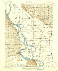
1920 Map of Craig
USGS Topo · Published 1939About this map
The Missouri River defines the landscape of this 1916 survey, carving a winding path that separates Richardson County, Nebraska, from Holt County, Missouri. The river valley is a corridor of intense transport and rural settlement, anchored by the Chicago Burlington and Quincy railroad, which links riverside towns like Craig, Bigelow, and Rulo. The map documents a dense network of one-room schoolhouses that once served this agricultural region, including uniquely named institutions such as Brush College School, Lonesome School, and Exodus School.
Find a feature on this map
56 named features on this map. Tap any name to fly to it.
Don’t see what you’re looking for? This feature index may not catch every label — zoom into the map to look around manually.
Map Details
Editions of this 1920 Craig Map
5 editions found
Other maps of this area

1885 · Atchison
USGS Topo · 1:125,000

1888 · Atchison
USGS Topo · 1:125,000

1888 · Hiawatha
USGS Topo · 1:125,000

1893 · Atchison
USGS Topo · 1:125,000

1894 · Hiawatha
USGS Topo · 1:125,000

1915 · Falls City
USGS Topo · 1:62,500

1915 · Nemaha
USGS Topo · 1:62,500

1920 · Craig
USGS Topo · 1:62,500

1926 · Oregon
USGS Topo · 1:62,500

1926 · Maitland
USGS Topo · 1:62,500