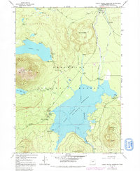
1963 Map of Crane Prairie Reservoir
USGS Topo · Published 1992About this map
Crane Prairie Reservoir dominates this central Oregon landscape, serving as a primary hub for mid-century recreation and forest management within the Deschutes National Forest. The map documents a transition from wild high-country terrain to managed reservoir waters, featuring established sites like Gales Landing and Robideau Landing. The topography is marked by volcanic features including Wuksi Butte and Shukash Butte, while the northern portion extends into the Three Sisters Wilderness near North Corral Lake.
Find a feature on this map
48 named features on this map. Tap any name to fly to it.
Don’t see what you’re looking for? This feature index may not catch every label — zoom into the map to look around manually.
Map Details
Editions of this 1963 Crane Prairie Reservoir Map
4 editions found
Other maps of this area

1930 · Maiden Peak
USGS Topo · 1:125,000

1934 · Maiden Peak
USGS Topo · 1:125,000

1955 · Crescent
USGS Topo · 1:250,000

1957 · Crescent
USGS Topo · 1:250,000

1958 · Crescent
USGS Topo · 1:250,000
1963 · Elk Lake
USGS Topo · 1:24,000

1963 · Round Mountain
USGS Topo · 1:24,000
1963 · The Twins
USGS Topo · 1:24,000
1963 · Irish Mountain
USGS Topo · 1:24,000
1963 · Packsaddle Mtn
USGS Topo · 1:24,000