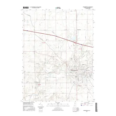
2016 Map of Crawfordsville
USGS Topo · Published 2016About this map
Crawfordsville serves as the central hub of this Indiana landscape, where the campus of Wabash Coll sits near the heart of the city. The settlement pattern is defined by the winding path of Sugar Creek, which flows past the outskirts of the main town and the small community of Yountsville to the southwest. The area is marked by a high density of rural and municipal burial grounds, ranging from the large Oak Hill Cem and Ben-Hur Cem near the city center to smaller family and pioneer plots like Potts Cem, Wilson Cem, and O'Neal Cem scattered across the countryside.
Find a feature on this map
85 named features on this map. Tap any name to fly to it.
Don’t see what you’re looking for? This feature index may not catch every label — zoom into the map to look around manually.
Map Details
Editions of this 2016 Crawfordsville Map
This is the sole edition of this map. No revisions or reprints were ever made.
Other maps of this area

1949 · Alamo
USGS Topo · 1:24,000

1953 · Danville
USGS Topo · 1:250,000

1953 · Indianapolis
USGS Topo · 1:250,000

1955 · Danville
USGS Topo · 1:250,000

1956 · Danville
USGS Topo · 1:250,000

1956 · Indianapolis
USGS Topo · 1:250,000

1956 · Crawfordsville
USGS Topo · 1:24,000

1956 · New Market
USGS Topo · 1:24,000

1957 · Indianapolis
USGS Topo · 1:250,000

1958 · Darlington
USGS Topo · 1:24,000