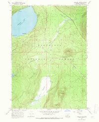
1967 Map of Crescent Lake
USGS Topo · Published 1971About this map
Crescent Lake dominates the upper northwestern corner of this landscape, its waters reaching into Simax Bay and past Zims Point. The Southern Pacific railroad line serves as a central spine through the Deschutes National Forest, connecting the small settlement of Umli to the broader Oregon rail network. The geography is defined by high volcanic landmarks, including the prominent cinder cone of Little Odell Butte and the towering heights of Beales Butte and Chinquapin Butte further south.
Find a feature on this map
21 named features on this map. Tap any name to fly to it.
Don’t see what you’re looking for? This feature index may not catch every label — zoom into the map to look around manually.
Map Details
Editions of this 1967 Crescent Lake Map
3 editions found
Other maps of this area

1917 · Diamond Lake
USGS Topo · 1:125,000

1925 · Waldo Lake
USGS Topo · 1:125,000

1930 · Maiden Peak
USGS Topo · 1:125,000

1934 · Maiden Peak
USGS Topo · 1:125,000

1935 · Chemult
USGS Topo · 1:96,000

1941 · Chemult
USGS Topo · 1:125,000

1955 · Crescent
USGS Topo · 1:250,000

1956 · Waldo Lake
USGS Topo · 1:62,500

1956 · Summit Lake
USGS Topo · 1:62,500

1957 · Crescent
USGS Topo · 1:250,000