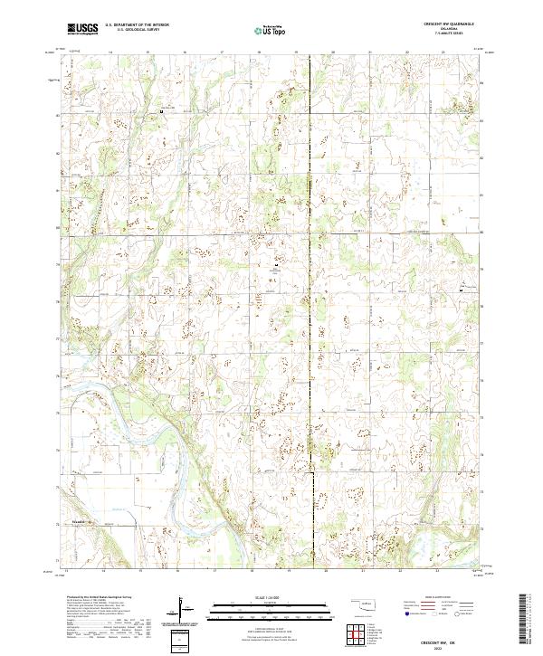
2022 Map of Crescent NW
USGS Topo · Published 2022About this map
The Cimarron River meanders across the southern portion of this landscape, carving a wide alluvial path through the plains of Central Oklahoma. As of 2022, the region remains defined by its section-line road network and rural character, with the Kingfisher Co Logan Co line bisecting the territory. The map highlights several quiet burial sites that anchor the local history, including Zion Community Cem and Oak Vale Cem in the north, and Oak Grove Cem further east. The small settlement of Wandel sits near the western edge along Walnut Cr, providing a focal point for researchers of local genealogy. Significant drainage systems such as W Fork Sooner Cr and E Fork Sooner Cr feed the larger river system, illustrating the natural water management of this agricultural prairie.
Find a feature on this map
40 named features on this map. Tap any name to fly to it.
Don’t see what you’re looking for? This feature index may not catch every label — zoom into the map to look around manually.
Map Details
Editions of this 2022 Crescent NW Map
This is the sole edition of this map. No revisions or reprints were ever made.
Other maps of this area

1892 · Kingfisher
USGS Topo · 1:125,000

1893 · Lovell
USGS Topo · 1:62,500

1893 · Hennessey
USGS Topo · 1:62,500

1895 · Kingfisher
USGS Topo · 1:125,000

1954 · Oklahoma City
USGS Topo · 1:250,000

1955 · Enid
USGS Topo · 1:250,000

1956 · Hennessey
USGS Topo · 1:62,500

1957 · Oklahoma City
USGS Topo · 1:250,000

1958 · Enid
USGS Topo · 1:250,000

1963 · Oklahoma City
USGS Topo · 1:250,000