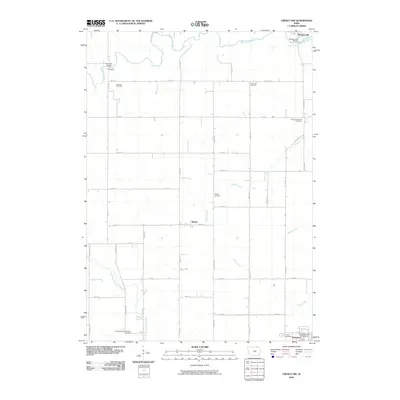
2010 Map of Cresco NW
USGS Topo · Published 2010About this map
Upper Iowa River meanders across the northern reaches of this Howard County landscape, connecting the small settlements of Foreston and Florenceville. The topography is defined by the transition between the river drainage in the north and the headwaters of the North Branch Turkey River in the southwest, reflecting the classic agricultural grid of the Iowa countryside. Genealogists will find significant value in the distribution of rural burial sites, including Foreston Cemetery, Cedar Hill Cemetery, and Albion Township Cemetery. In the south, the map captures the northern outskirts of Cresco, featuring the Howard County Fairground and the Calvary Cemetery. Small hamlets like Bonair are situated along the intersecting avenues and numbered streets, providing a detailed view of the regional infrastructure as it existed in the early 21st century.
Find a feature on this map
41 named features on this map. Tap any name to fly to it.
Don’t see what you’re looking for? This feature index may not catch every label — zoom into the map to look around manually.
Map Details
Editions of this 2010 Cresco NW Map
This is the sole edition of this map. No revisions or reprints were ever made.
Other maps of this area

1954 · Mason City
USGS Topo · 1:250,000

1957 · Mason City
USGS Topo · 1:250,000

1958 · Mason City
USGS Topo · 1:250,000

1965 · Greenleafton
USGS Topo · 1:24,000

1965 · Harmony
USGS Topo · 1:24,000

1965 · Cherry Grove
USGS Topo · 1:24,000

1981 · Lourdes
USGS Topo · 1:24,000

1981 · Cresco NW
USGS Topo · 1:24,000
1981 · Cresco NE
USGS Topo · 1:24,000

1981 · Lime Springs
USGS Topo · 1:24,000