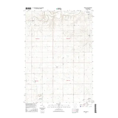
2015 Map of Cresco NW
USGS Topo · Published 2015About this map
Florenceville sits at the northern edge of this Howard County landscape, where the Upper Iowa River carves a winding path through the limestone-rich terrain of northeastern Iowa. This survey reveals a highly organized rural grid, defined by a network of gravel and paved roads named after birds and trees, such as Quail Ave and Saint Ave. The area is a center for township life, evidenced by the numerous burial grounds like Albion Township Cem and Howard Center Township Cem that mark the legacy of early farming families. The transition between watersheds is notable here, as the terrain shifts from the northern river bluffs toward the south, where the N Br Turkey River and Silver Cr begin their descent. Small communities like Bonair and the northwestern edge of Cresco anchor the southern reaches, connected by straight sections of the Iowa road system.
Find a feature on this map
45 named features on this map. Tap any name to fly to it.
Don’t see what you’re looking for? This feature index may not catch every label — zoom into the map to look around manually.
Map Details
Editions of this 2015 Cresco NW Map
This is the sole edition of this map. No revisions or reprints were ever made.
Other maps of this area

1954 · Mason City
USGS Topo · 1:250,000

1957 · Mason City
USGS Topo · 1:250,000

1958 · Mason City
USGS Topo · 1:250,000

1965 · Greenleafton
USGS Topo · 1:24,000

1965 · Harmony
USGS Topo · 1:24,000

1965 · Cherry Grove
USGS Topo · 1:24,000

1981 · Lourdes
USGS Topo · 1:24,000

1981 · Cresco NW
USGS Topo · 1:24,000
1981 · Cresco NE
USGS Topo · 1:24,000

1981 · Lime Springs
USGS Topo · 1:24,000