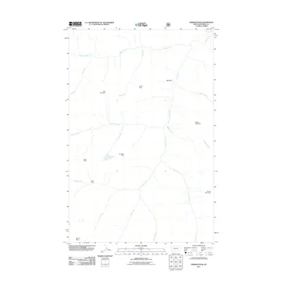
2011 Map of Crimson Peak
USGS Topo · Published 2011About this map
Crimson Lake lies at the heart of this high-elevation landscape in Powell County, situated below the prominent summit of Crimson Peak. The area is defined by a complex drainage network where Youngs Creek and its many tributaries, including Babcock Creek and Marshall Creek, carve through the mountainous terrain. Notable summits like Goat Mountain, Railley Mountain, and Leota Peak frame the wilderness character of the region. The map reveals the dramatic geography of the Continental Divide's surroundings, including the distinctive Big Slide on the eastern slopes and the open expanse of Leota Park to the southwest. This 2011 survey documents the hydrography of the upper reaches of the drainage basins, showing how seasonal flows from Jenny Creek and Spruce Creek converge in this remote part of the Rockies.
Find a feature on this map
23 named features on this map. Tap any name to fly to it.
Don’t see what you’re looking for? This feature index may not catch every label — zoom into the map to look around manually.
Map Details
Editions of this 2011 Crimson Peak Map
This is the sole edition of this map. No revisions or reprints were ever made.
Other maps of this area

1902 · Ovando
USGS Topo · 1:125,000

1905 · Ovando
USGS Topo · 1:125,000

1955 · Choteau
USGS Topo · 1:250,000

1957 · Choteau
USGS Topo · 1:250,000

1958 · Choteau
USGS Topo · 1:250,000

1962 · Choteau
USGS Topo · 1:250,000

1965 · Morrell Mountain
USGS Topo · 1:24,000
1965 · Seeley Lake East
USGS Topo · 1:24,000

1968 · Dunham Point
USGS Topo · 1:24,000
1970 · Crimson Peak
USGS Topo · 1:24,000