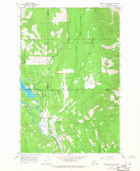
1965 Map of Seeley Lake East
USGS Topo · Published 1968About this map
Seeley Lake serves as the central focal point for this mid-1960s survey of the Clearwater Valley, where the townsite is depicted alongside essential civic landmarks like the Seeley Swan High Sch. The landscape is a complex intersection of conservation and recreation boundaries, including the Seeley Lake Game Preserve, Lolo National Forest, and Clearwater State Forest. Transportation in this mountain environment is defined by simple trails and the Seeley Lake Landing Strip, reflecting the region's reliance on aviation and foot travel for backcountry access.
Find a feature on this map
23 named features on this map. Tap any name to fly to it.
Don’t see what you’re looking for? This feature index may not catch every label — zoom into the map to look around manually.
Map Details
Editions of this 1965 Seeley Lake East Map
2 editions found
Other maps of this area

1902 · Ovando
USGS Topo · 1:125,000

1905 · Ovando
USGS Topo · 1:125,000

1921 · Elbow Lake
USGS Topo · 1:125,000

1955 · Choteau
USGS Topo · 1:250,000

1957 · Choteau
USGS Topo · 1:250,000

1958 · Choteau
USGS Topo · 1:250,000

1962 · Choteau
USGS Topo · 1:250,000
1965 · Woodworth
USGS Topo · 1:24,000

1965 · Morrell Mountain
USGS Topo · 1:24,000

1965 · Seeley Lake West
USGS Topo · 1:24,000