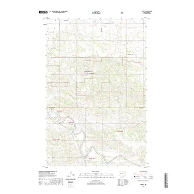
2020 Map of Croff
USGS Topo · Published 2020About this map
The Little Missouri National Grassland dominates the central portion of this North Dakota landscape, where the broken terrain of the Badlands begins to give way to the winding course of the Little Missouri River. This 2020 survey reveals a land defined by its complex drainage network, where seasonal waterways like Bear Den Cr and Deep Cr carve deep into the plateau. The map details the transition across the McKenzie and Dunn County line, capturing the sparse but critical transportation network serving this cattle-ranching and energy-producing region. Section lines and gravel routes such as Bear Den Rd and 114 Ave NW grid the high ground between the draws of Lone Beaver Cr and Burnt Cr, illustrating the orderly land management imposed on a physically complex and erosion-carved environment.
Find a feature on this map
16 named features on this map. Tap any name to fly to it.
Don’t see what you’re looking for? This feature index may not catch every label — zoom into the map to look around manually.
Map Details
Editions of this 2020 Croff Map
This is the sole edition of this map. No revisions or reprints were ever made.
Other maps of this area

1953 · Watford City
USGS Topo · 1:250,000

1957 · Watford City
USGS Topo · 1:250,000

1958 · Lone Butte SE
USGS Topo · 1:24,000

1958 · North Killdeer Mountain
USGS Topo · 1:24,000

1959 · Croff
USGS Topo · 1:24,000

1959 · Lone Butte NE
USGS Topo · 1:24,000

1965 · Johnsons Corner
USGS Topo · 1:24,000

1965 · Blue Buttes SE
USGS Topo · 1:24,000

1967 · Watford City
USGS Topo · 1:250,000

1970 · Lost Bridge
USGS Topo · 1:24,000