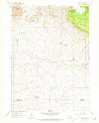
1961 Map of Crooks Peak
USGS Topo · Published 1973About this map
Crooks Peak rises over a high-desert landscape defined by complex drainage networks and traditional ranching life in the early 1960s. This survey, grounded in 1961 field observations, captures the remote character of Fremont Co and Sweetwater Co near the southern edge of the Granite Mountains. Local water sources are critical to this terrain, marked by Crooks Creek Reservoir, Sand Spring, and Bare Ring Slough. The presence of the Jenson Ranch near Taggart Meadows reflects the area's agricultural roots, while a lone Mine and a prominent Pipeline suggest the beginning of industrial mineral and energy development. The geography is further distinguished by significant landforms like Sheep Mountain, Green Mountain, and the notable pass at Crooks Gap, which historically served as a gateway through the surrounding ridges.
Find a feature on this map
20 named features on this map. Tap any name to fly to it.
Don’t see what you’re looking for? This feature index may not catch every label — zoom into the map to look around manually.
Map Details
Editions of this 1961 Crooks Peak Map
3 editions found
Other maps of this area

1951 · Crooks Creek NE
USGS Topo · 1:24,000

1951 · Split Rock NW
USGS Topo · 1:24,000

1951 · Crooks Mountain
USGS Topo · 1:24,000

1955 · Casper
USGS Topo · 1:250,000

1957 · Jeffrey City
USGS Topo · 1:24,000

1958 · Casper
USGS Topo · 1:250,000
1961 · Osborne Well
USGS Topo · 1:24,000
1961 · Antelope Reservoir
USGS Topo · 1:24,000

1961 · Hadsell Spring
USGS Topo · 1:24,000

1961 · Crooks Peak
USGS Topo · 1:24,000