
1948 Map of Crosby
USGS Topo · Published 1948About this map
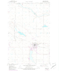
Crosby serves as the focal point of this late 1940s survey of Divide County, positioned just south of the United States-Canada border. The landscape is defined by the open Prairie and the winding course of Long Creek, which cuts through the northern townships of Blooming and Fillmore. This era reveals a town deeply integrated into the regional transportation network, where the Minneapolis St Paul and Sault Ste Marie and Great Northern railroads intersect near the center of the settlement.
Find a feature on this map
18 named features on this map. Tap any name to fly to it.
Don’t see what you’re looking for? This feature index may not catch every label — zoom into the map to look around manually.
Map Details
Editions of this 1948 Crosby Map
2 editions found
Other maps of this area

1948 · Crosby SW
USGS Topo · 1:24,000

1948 · Ambrose
USGS Topo · 1:24,000

1948 · Crosby SE
USGS Topo · 1:24,000

1949 · Paulson
USGS Topo · 1:24,000

1949 · Noonan SW
USGS Topo · 1:24,000

1950 · Crosby
USGS Topo · 1:62,500

1950 · Noonan
USGS Topo · 1:62,500

1953 · Williston
USGS Topo · 1:250,000

1957 · Williston
USGS Topo · 1:250,000

1984 · Crosby
USGS Topo · 1:100,000