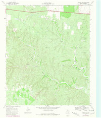
1968 Map of Croton Camp
USGS Topo · Published 1981About this map
The Croton Breaks dominate this section of Dickens County, where the deeply eroded drainage basins of Croton Creek and Little Croton Creek create a complex landscape of draws and ridges. During the late 1960s, this area remained largely defined by ranching infrastructure and early industrial exploration. The presence of Oil Wells and a remote Landing Strip in the southwest corner indicates the growing importance of petroleum extraction in the West Texas plains.
Find a feature on this map
20 named features on this map. Tap any name to fly to it.
Don’t see what you’re looking for? This feature index may not catch every label — zoom into the map to look around manually.
Map Details
Editions of this 1968 Croton Camp Map
2 editions found
Other maps of this area

1954 · Lubbock
USGS Topo · 1:250,000

1958 · Pursley House
USGS Topo · 1:24,000

1959 · Gilpin
USGS Topo · 1:24,000

1967 · Dickens North
USGS Topo · 1:24,000

1967 · Dickens South
USGS Topo · 1:24,000

1967 · Spur
USGS Topo · 1:24,000

1968 · East Afton
USGS Topo · 1:24,000

1968 · Pitchfork Ranch
USGS Topo · 1:24,000

1968 · Croton Camp
USGS Topo · 1:24,000

1968 · East Afton NE
USGS Topo · 1:24,000