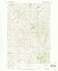
1967 Map of Crow Agency SE
USGS Topo · Published 1971About this map
Custer Battlefield National Monument (Reno-Benteen Battle Site) occupies the southern portion of this Big Horn County landscape, marking the historic grounds of the Reno-Benteen engagement. The terrain is defined by the drainage systems of Medicine Tail Coulee and Reno Creek, which cut through the high plains. The map illustrates a transitional period in the late 1960s where traditional grazing lands met modern infrastructure, such as the Conley Landing Strip. Detailed topographic contours reveal the complex ridges and draws that influenced the historical military movements in this area, including the pathways along Ash Creek and the North Fork Reno Creek. This survey provides a precise look at the land forms as they existed before subsequent decades of visitation and park development altered the immediate surroundings of the monument.
Find a feature on this map
11 named features on this map. Tap any name to fly to it.
Don’t see what you’re looking for? This feature index may not catch every label — zoom into the map to look around manually.
Map Details
Editions of this 1967 Crow Agency SE Map
3 editions found
Other maps of this area

1894 · Rosebud
USGS Topo · 1:125,000

1901 · Rosebud
USGS Topo · 1:125,000

1954 · Hardin
USGS Topo · 1:250,000

1957 · Hardin
USGS Topo · 1:250,000

1958 · Hardin
USGS Topo · 1:250,000

1967 · Jeans Fork NW
USGS Topo · 1:24,000

1967 · Crow Agency NE
USGS Topo · 1:24,000

1967 · Crow Agency SE
USGS Topo · 1:24,000

1967 · Lodge Grass NE
USGS Topo · 1:24,000
1967 · Benteen
USGS Topo · 1:24,000