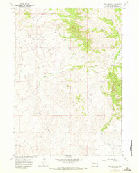
1967 Map of Crow Mountain
USGS Topo · Published 1972About this map
Mountain Meadows and high-altitude plateaus define this corner of the Wind River Indian Reservation in the late 1960s. The landscape is dominated by the massive profile of Crow Mountain, which overlooks the deeply etched drainage of Crow Creek Canyon and the expansive Crow Creek Basin to the east. This terrain is characterized by a network of seasonal water sources such as Cantrell Spring and several unnamed springs that supported the area's grazing and wildlife.
Find a feature on this map
22 named features on this map. Tap any name to fly to it.
Don’t see what you’re looking for? This feature index may not catch every label — zoom into the map to look around manually.
Map Details
Editions of this 1967 Crow Mountain Map
2 editions found
Other maps of this area

1904 · Kirwin
USGS Topo · 1:125,000

1906 · Kirwin
USGS Topo · 1:125,000

1952 · Wilderness
USGS Topo · 1:24,000

1952 · Crowheart NW
USGS Topo · 1:24,000

1952 · Blue Holes
USGS Topo · 1:24,000

1955 · Thermopolis
USGS Topo · 1:250,000

1958 · Thermopolis
USGS Topo · 1:250,000

1962 · Thermopolis
USGS Topo · 1:250,000
1967 · Bain Draw
USGS Topo · 1:24,000

1967 · Monument Peak
USGS Topo · 1:24,000