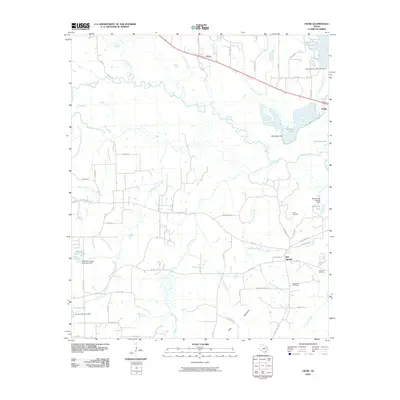
2010 Map of Crow
USGS Topo · Published 2010About this map
The Red Springs Oil Field and the surrounding timberland of Wood County define this landscape along the winding course of the Sabine River. In this 2010 survey, the region around the communities of Red Springs and Crow is characterized by a high density of small, private reservoirs and club lakes, including American Legion Lake, Brumley Lake, and Lorraine Lake. These water bodies are fed by a complex drainage network of creeks like North Prairie Creek and Saline Creek. Traces of the region's earlier transportation history are preserved in the path of the Old Dallas-Shreveport Rd, while local genealogical sites such as White Cemetery and Marshall Cemetery remain significant landmarks for researchers. The map also captures smaller settlements and railroad points like Angler and Todd, illustrating the rural development patterns of East Texas.
Find a feature on this map
60 named features on this map. Tap any name to fly to it.
Don’t see what you’re looking for? This feature index may not catch every label — zoom into the map to look around manually.
Map Details
Editions of this 2010 Crow Map
This is the sole edition of this map. No revisions or reprints were ever made.
Other maps of this area

1938 · Winona
USGS Topo · 1:48,000

1943 · Winona
USGS Topo · 1:62,500

1948 · Tyler
USGS Topo · 1:62,500

1949 · Tyler
USGS Topo · 1:62,500

1956 · Tyler
USGS Topo · 1:250,000

1960 · Shady Grove
USGS Topo · 1:24,000

1960 · Hawkins
USGS Topo · 1:24,000

1960 · Hainesville
USGS Topo · 1:24,000

1960 · Lindale
USGS Topo · 1:24,000

1960 · Mineola
USGS Topo · 1:24,000