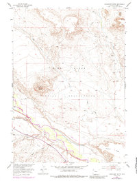
1952 Map of Crowheart Butte
USGS Topo · Published 1984About this map
Wind River Indian Reservation lands dominate this mid-century landscape, defined by the prominent silhouette of Crowheart Butte rising above the plains. The Wind River flows through the southern half of the quadrangle, joined by a complex network of seasonal drainages including Cleveland Draw, Ega Draw, and Dry Creek. Surveyed in the late 1940s and early 1950s, the map illustrates a sparsely settled area where terrain dictated movement and utility. Notable human imprints are limited but specific, including a Landing Strip near the river and the foot of Stagner Ridge. The topography is particularly detailed around the distinct buttes, such as Teapot Butte in the northeast, providing a clear record of the geological formations and watercourses like Little Sand Draw and Sand Draw that have shaped this portion of Fremont County.
Find a feature on this map
12 named features on this map. Tap any name to fly to it.
Don’t see what you’re looking for? This feature index may not catch every label — zoom into the map to look around manually.
Map Details
Editions of this 1952 Crowheart Butte Map
3 editions found
Other maps of this area

1951 · Lookout Butte SW
USGS Topo · 1:24,000

1951 · Bull Lake East
USGS Topo · 1:24,000

1951 · Argo Butte
USGS Topo · 1:24,000

1951 · Maverick Spring
USGS Topo · 1:24,000

1952 · Crowheart Butte
USGS Topo · 1:24,000

1952 · Crowheart NW
USGS Topo · 1:24,000

1952 · Crowheart NE
USGS Topo · 1:24,000

1952 · Bull Lake West
USGS Topo · 1:24,000

1952 · Crowheart
USGS Topo · 1:24,000

1955 · Thermopolis
USGS Topo · 1:250,000