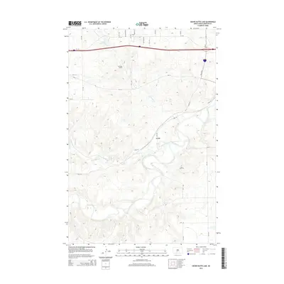
2014 Map of Crown Butte Lake
USGS Topo · Published 2014About this map
The Heart River winds through the southeastern portion of this Morton County landscape, where the settlement of Lyons serves as a local waypoint along Lyons Rd. This area is defined by the confluence of local drainages, including Sweetbriar Creek and Crown Butte Cr, which feeds into the recreational waters of Crown Butte Lake in the northwest. The terrain reveals a transition from these riparian corridors to upland plateaus, punctuated by local infrastructure like the Z P Field Airport and the north-south alignment of ND 25. Researchers will find significant local history markers such as the Heart River Cem, situated on the bluffs overlooking the river valley. The infrastructure is modern, dominated by the corridor of Interstate 94 and its associated Bus Loop I 94, yet the underlying topography remains the primary focus of this early 21st-century survey.
Find a feature on this map
27 named features on this map. Tap any name to fly to it.
Don’t see what you’re looking for? This feature index may not catch every label — zoom into the map to look around manually.
Map Details
Editions of this 2014 Crown Butte Lake Map
This is the sole edition of this map. No revisions or reprints were ever made.
Other maps of this area

1907 · Bismarck
USGS Topo · 1:125,000

1951 · Bismarck
USGS Topo · 1:62,500

1951 · Mandan
USGS Topo · 1:24,000

1954 · Bismarck
USGS Topo · 1:250,000

1958 · Bismarck
USGS Topo · 1:250,000

1962 · Harmon
USGS Topo · 1:24,000

1962 · Mandan
USGS Topo · 1:24,000

1972 · Sweet Briar
USGS Topo · 1:24,000

1972 · Crown Butte Lake
USGS Topo · 1:24,000

1972 · Crown Butte NW
USGS Topo · 1:24,000