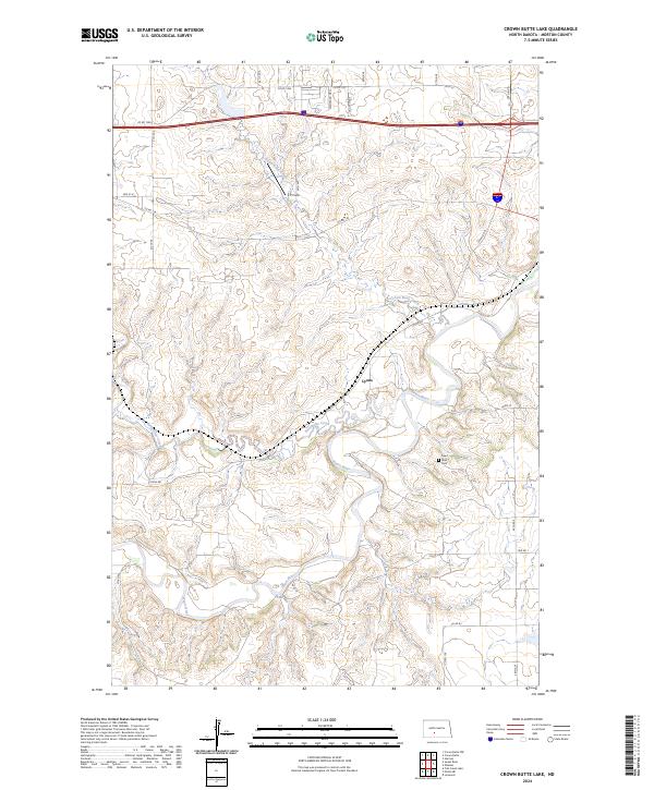
2024 Map of Crown Butte Lake
USGS Topo · Published 2024About this map
Heart River meanders through the southern half of this Morton County landscape, joined by its tributaries Sweetbriar Creek and Crown Butte Creek. The terrain is characterized by the complex drainages and coulees typical of the Missouri Plateau, where rural life is organized around a network of county roads including Co Rd 139 and Lyons Rd. In the central section, the settlement of Lyons sits near the riverbanks, serving as a local focal point alongside the nearby Heart River Cem.
Find a feature on this map
29 named features on this map. Tap any name to fly to it.
Don’t see what you’re looking for? This feature index may not catch every label — zoom into the map to look around manually.
Map Details
Editions of this 2024 Crown Butte Lake Map
This is the sole edition of this map. No revisions or reprints were ever made.
Other maps of this area

1907 · Bismarck
USGS Topo · 1:125,000

1951 · Bismarck
USGS Topo · 1:62,500

1951 · Mandan
USGS Topo · 1:24,000

1954 · Bismarck
USGS Topo · 1:250,000

1958 · Bismarck
USGS Topo · 1:250,000

1962 · Harmon
USGS Topo · 1:24,000

1962 · Mandan
USGS Topo · 1:24,000

1972 · Sweet Briar
USGS Topo · 1:24,000

1972 · Crown Butte Lake
USGS Topo · 1:24,000

1972 · Crown Butte NW
USGS Topo · 1:24,000