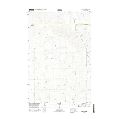
2014 Map of Crown Butte
USGS Topo · Published 2014About this map
Crown Butte rises as a prominent landmark in this prairie landscape along the border of Oliver Co and Morton Co. The terrain is defined by a dendritic drainage pattern where Square Butte Cr and Otter Cr cut through the high plains, eventually joined by Crown Butte Cr to the south. This 2014 survey reveals a transition from traditional rural section-line roads like 31st ST and 30th Ave to a pocket of modern residential development in the northeast near ND-25. Here, newer named thoroughfares such as Charlotte Dr N, Jonathan Dr N, and Wisor Pl N suggest the expanding footprint of the nearby regional hub, contrasting with the open ranchland that dominates the western portion of the quadrangle.
Find a feature on this map
28 named features on this map. Tap any name to fly to it.
Don’t see what you’re looking for? This feature index may not catch every label — zoom into the map to look around manually.
Map Details
Editions of this 2014 Crown Butte Map
This is the sole edition of this map. No revisions or reprints were ever made.
Other maps of this area

1907 · Bismarck
USGS Topo · 1:125,000

1950 · Wilton
USGS Topo · 1:62,500

1951 · Bismarck
USGS Topo · 1:62,500

1951 · Mandan
USGS Topo · 1:24,000

1954 · Bismarck
USGS Topo · 1:250,000

1954 · McClusky
USGS Topo · 1:250,000

1958 · Bismarck
USGS Topo · 1:250,000

1958 · McClusky
USGS Topo · 1:250,000

1962 · Harmon
USGS Topo · 1:24,000

1962 · Mandan
USGS Topo · 1:24,000