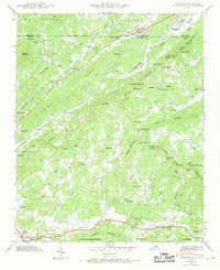
1941 Map of Culberson
USGS Topo · Published 1969About this map
Louisville and Nashville tracks and a web of mountain gaps define the landscape of the Blue Ridge foothills along the border of Georgia and North Carolina. In the early 1940s, this area was a patchwork of small communities like Culberson and Sweet Gum, where local life centered around rural institutions such as New Liberty Ch and Bell Sch. The rugged terrain of Thomas Mountain and Mull Mountain is dissected by numerous waterways, including the Nottely River and Hemptown Creek. A significant agrarian and industrial history is evident through numerous small-scale operations like Forge Mill, Brown Mill, and Sparks Mill, which utilized the local branches and creeks. From the Paris Cem to the high points of Poindexter Knob, the map documents a transition from the Nantahala National Forest down toward the southern settlements of Morganton and Coles Crossing.
Find a feature on this map
96 named features on this map. Tap any name to fly to it.
Don’t see what you’re looking for? This feature index may not catch every label — zoom into the map to look around manually.
Map Details
Editions of this 1941 Culberson Map
4 editions found
Other maps of this area

1888 · Ellijay
USGS Topo · 1:125,000

1892 · Ellijay
USGS Topo · 1:125,000

1893 · Murphy
USGS Topo · 1:125,000

1898 · Ellijay
USGS Topo · 1:125,000

1911 · Ellijay
USGS Topo · 1:125,000

1914 · Murphy
USGS Topo · 1:125,000

1934 · Murphy
USGS Topo · 1:24,000

1934 · Persimmon Creek
USGS Topo · 1:24,000

1934 · Murphy
USGS Topo · 1:48,000

1935 · Ivylog
USGS Topo · 1:24,000