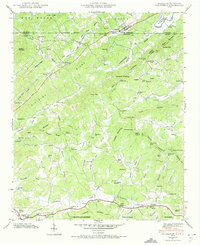
1941 Map of Culberson
USGS Topo · Published 1973About this map
The Louisville and Nashville railroad carves through the northern borderlands of Georgia and North Carolina, following the South Fork Rapier Mill Creek toward the village of Culberson. This 1941 survey captures a landscape of small agricultural communities and family-named landmarks just as the Tennessee Valley Authority was reshaping the region. In the southern portion of the map, the settlement of Morganton sits near Hemptown Creek, surrounded by a high density of rural institutions like Bethel Ch and the Hemp Sch. Local industry is evidenced by numerous water-powered sites such as Forge Mill, Sparks Mill, and Mashburn Mill. The presence of Paris Cem and numerous country churches, including Jerusalem Ch and Long Chapel, offers significant value for genealogists tracing families in the Blue Ridge foothills.
Find a feature on this map
88 named features on this map. Tap any name to fly to it.
Don’t see what you’re looking for? This feature index may not catch every label — zoom into the map to look around manually.
Map Details
Editions of this 1941 Culberson Map
4 editions found
Other maps of this area

1888 · Ellijay
USGS Topo · 1:125,000

1892 · Ellijay
USGS Topo · 1:125,000

1893 · Murphy
USGS Topo · 1:125,000

1898 · Ellijay
USGS Topo · 1:125,000

1911 · Ellijay
USGS Topo · 1:125,000

1914 · Murphy
USGS Topo · 1:125,000

1934 · Murphy
USGS Topo · 1:24,000

1934 · Persimmon Creek
USGS Topo · 1:24,000

1934 · Murphy
USGS Topo · 1:48,000

1935 · Ivylog
USGS Topo · 1:24,000