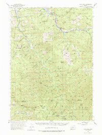
1955 Map of Culp Creek
USGS Topo · Published 1978About this map
The Oregon Pacific and Eastern RR serves as a central artery through this timber-rich region of the Cascades foothills, following the Row River through the settlements of Dorena, Culp Creek, and Disston. This mid-century landscape shows the significant infrastructure of the timber and mining industries, including the Silica Camp and the prominent Silica Mtn. Cultural markers for genealogists and local historians are well-preserved, from the Broumbaugh Cem in the northwest to schools like Blue Mtn Sch and the Dorena School. The map also captures the Dorena Lake reservoir and several engineering details like the Covered Bridge and a Covered Footbridge over the river. Higher elevations within the Umpqua National Forest feature fire protection infrastructure like the Shirley Gap Lookout and several peaks such as Burnt Mtn and Snow Peak.
Find a feature on this map
100 named features on this map. Tap any name to fly to it.
Don’t see what you’re looking for? This feature index may not catch every label — zoom into the map to look around manually.
Map Details
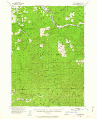
Editions of this 1955 Culp Creek Map
3 editions found

Other maps of this area

1897 · Roseburg
USGS Topo · 1:125,000

1900 · Roseburg
USGS Topo · 1:125,000

1921 · Cottage Grove
USGS Topo · 1:62,500

1935 · Lowell
USGS Topo · 1:96,000

1942 · Lowell
USGS Topo · 1:125,000

1954 · Anlauf
USGS Topo · 1:62,500

1954 · Glide
USGS Topo · 1:62,500

1955 · Hardesty Mtn
USGS Topo · 1:62,500

1955 · Mace Mtn
USGS Topo · 1:62,500

1955 · Illahee Rock
USGS Topo · 1:62,500