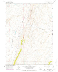
1962 Map of Cumberland Gap
USGS Topo · Published 1979About this map
Oyster Ridge and The Hogsback define the linear, north-south grain of this Wyoming landscape, where the coal industry and early transit corridors met in the late nineteenth and early twentieth centuries. The Union Pacific Railroad Old North Fork Grade traces a path through the valley, passing near the industrial remains of the Brilliant No 8 Mine and its associated Reservoir. This area reflects the transition from intensive mining to livestock ranching, as seen in the presence of the Company Ranch and Ziller Ranch scattered among the drainages of Little Muddy Creek and Albert Creek. Genealogists and local historians can locate the Cumberland Cem and the Storm Shelter Cabin No 2, markers of the community that once thrived around the Cumberland Gap before the 1960s photogrammetric survey and 1970s revisions recorded these enduring landmarks.
Find a feature on this map
23 named features on this map. Tap any name to fly to it.
Don’t see what you’re looking for? This feature index may not catch every label — zoom into the map to look around manually.
Map Details
Editions of this 1962 Cumberland Gap Map
2 editions found
Other maps of this area

1954 · Ogden
USGS Topo · 1:250,000

1958 · Ogden
USGS Topo · 1:250,000

1960 · Ogden
USGS Topo · 1:250,000

1962 · Cumberland Gap
USGS Topo · 1:24,000

1962 · Elkol SW
USGS Topo · 1:24,000

1962 · Elkol
USGS Topo · 1:24,000

1962 · Warfield Creek
USGS Topo · 1:24,000

1964 · Carter
USGS Topo · 1:24,000

1965 · Bridger
USGS Topo · 1:24,000

1965 · Meadow Draw
USGS Topo · 1:24,000