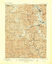
1911 Map of Cumberland
USGS Topo · Published 1948About this map
The rolling landscape of southeastern Ohio at the dawn of the 1910s reveals a region deeply shaped by the Baltimore and Ohio RR and the Pennsylvania RR. This survey captures the rural network of Guernsey, Noble, and Muskingum counties, where industry and education appear as primary landmarks. Settlements like Byesville and Cumberland serve as hubs, while the map records a dense distribution of local schools, including the curiously named Rough and Ready School and Gilt Edge School.
Find a feature on this map
126 named features on this map. Tap any name to fly to it.
Don’t see what you’re looking for? This feature index may not catch every label — zoom into the map to look around manually.
Map Details
Editions of this 1911 Cumberland Map
2 editions found

Other maps of this area

1903 · Macksburg
USGS Topo · 1:62,500

1905 · Macksburg
USGS Topo · 1:62,500

1908 · Conesville
USGS Topo · 1:62,500

1909 · Antrim
USGS Topo · 1:48,000

1909 · Caldwell
USGS Topo · 1:62,500

1909 · Summerfield
USGS Topo · 1:62,500

1909 · Cambridge
USGS Topo · 1:62,500

1910 · Philo
USGS Topo · 1:62,500

1910 · Conesville
USGS Topo · 1:62,500

1910 · Mc Connelsville
USGS Topo · 1:62,500