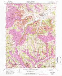
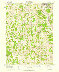
1961 Map of Cumberland
USGS Topo · Published 1987About this map
Cumberland sits at the convergence of multiple townships and counties, serving as a focal point for this landscape in the 1960s. The map illustrates a region undergoing significant transformation, where traditional farming communities like Zeno and Young Hickory exist alongside extensive Reclaimed Strip Mine operations. These purple-shaded reclamation areas indicate a shifting economy where extraction and environmental restoration have reshaped the terrain of Coal Hill.
Find a feature on this map
37 named features on this map. Tap any name to fly to it.
Don’t see what you’re looking for? This feature index may not catch every label — zoom into the map to look around manually.
Map Details
Editions of this 1961 Cumberland Map
4 editions found
Other maps of this area

1909 · Caldwell
USGS Topo · 1:62,500

1910 · Philo
USGS Topo · 1:62,500

1910 · Mc Connelsville
USGS Topo · 1:62,500

1911 · Cumberland
USGS Topo · 1:62,500

1912 · Caldwell
USGS Topo · 1:62,500

1949 · Clarksburg
USGS Topo · 1:250,000

1956 · Clarksburg
USGS Topo · 1:250,000

1961 · Clarksburg
USGS Topo · 1:250,000

1961 · Mc Connelsville
USGS Topo · 1:24,000
1961 · Caldwell South
USGS Topo · 1:24,000