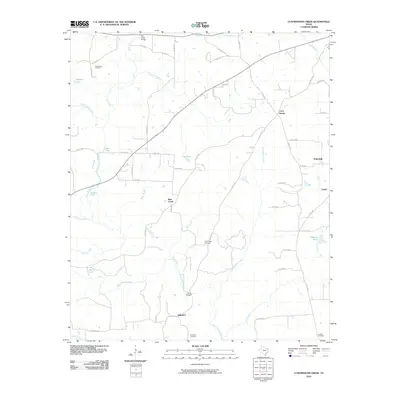
2010 Map of Cunningham Creek
USGS Topo · Published 2010About this map
Black Cypress Creek and its many tributaries, including Bear Creek and Cunningham Creek, define the water-rich landscape of Cass County in this 2010 survey. The area is characterized by a dense network of country roads connecting small settlements like Fairview and Lanier with the community of Liberty in the south. This modern topographic record captures the distribution of family and community landmarks that have anchored the region for generations.
Find a feature on this map
64 named features on this map. Tap any name to fly to it.
Don’t see what you’re looking for? This feature index may not catch every label — zoom into the map to look around manually.
Map Details
Editions of this 2010 Cunningham Creek Map
This is the sole edition of this map. No revisions or reprints were ever made.
Other maps of this area

1910 · Linden
USGS Topo · 1:62,500

1914 · Daingerfield
USGS Topo · 1:62,500

1953 · Texarkana
USGS Topo · 1:250,000

1956 · Texarkana
USGS Topo · 1:250,000

1956 · Tyler
USGS Topo · 1:250,000

1961 · Cunningham Creek
USGS Topo · 1:24,000

1961 · Lassater
USGS Topo · 1:24,000

1962 · Kellyville
USGS Topo · 1:24,000

1962 · Lanier
USGS Topo · 1:24,000

1962 · Jefferson
USGS Topo · 1:24,000