
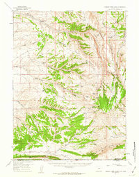
1957 Map of Currant Creek Ranch
USGS Topo · Published 1959About this map
Currant Creek Ranch sits at the northern end of this high-altitude landscape, where the high-plains geography of Sweetwater County, Wyoming meets the Richards Mountains along the Utah border. The 1950s terrain is defined by a dense network of seasonal water sources and livestock-supporting features, such as Sugarloaf Reservoir and Greenhough Place. The drainage patterns of Currant Creek and Middle Marsh Creek reveal a reliance on dispersed springs, including Louis George Spring and Richards Spring, which were vital for ranching operations in this arid region. High ridges like Hogback Ridge and Flat Iron Ridge segment the territory, while the Canyon Road Trail and various jeep trails provide the only access through the southern gaps. The survey captures the isolation of the Daggett County line before modern development, preserving the locations of remote landmarks like Hawks Nest and Minnies Gap.
Find a feature on this map
50 named features on this map. Tap any name to fly to it.
Don’t see what you’re looking for? This feature index may not catch every label — zoom into the map to look around manually.
Map Details
Editions of this 1957 Currant Creek Ranch Map
2 editions found
Other maps of this area

1885 · Ashley
USGS Topo · 1:250,000

1906 · Marsh Peak
USGS Topo · 1:125,000

1908 · Marsh Peak
USGS Topo · 1:125,000

1952 · Clay Basin
USGS Topo · 1:24,000

1952 · Dutch John Mtn
USGS Topo · 1:24,000

1952 · Goslin Mtn
USGS Topo · 1:24,000

1952 · Flaming Gorge
USGS Topo · 1:24,000

1954 · Vernal
USGS Topo · 1:250,000

1954 · Rock Springs
USGS Topo · 1:250,000

1957 · Mc Kinnon Junction
USGS Topo · 1:62,500