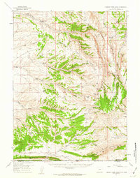
1957 Map of Currant Creek Ranch
USGS Topo · Published 1963About this map
Currant Creek Ranch and the isolated outposts of Hawks Nest and Greenhough Place anchor this 1957 mapping of the high desert terrain along the Wyoming-Utah border. The landscape is defined by its water management and grazing history, centered on the Currant Creek drainage and its network of springs and marshy basins like Jarvies Marsh and Krause Marsh. To the south, the massive rise of the Richards Mountains and West Mountain transitions into The Glades as the terrain falls toward the state line. Topographic details reveal a network of stock-rearing landmarks, from the natural fencing of Hogback Ridge and Flat Iron Ridge to the Sugarloaf Reservoir and family-named pastures like Janes Meadow. Jeep trails and canyon roads snake through the Sugarloaf Basin, documenting the era's land use before major modernization altered the region.
Find a feature on this map
61 named features on this map. Tap any name to fly to it.
Don’t see what you’re looking for? This feature index may not catch every label — zoom into the map to look around manually.
Map Details
Editions of this 1957 Currant Creek Ranch Map
2 editions found
Other maps of this area

1885 · Ashley
USGS Topo · 1:250,000

1906 · Marsh Peak
USGS Topo · 1:125,000

1908 · Marsh Peak
USGS Topo · 1:125,000

1952 · Clay Basin
USGS Topo · 1:24,000

1952 · Dutch John Mtn
USGS Topo · 1:24,000

1952 · Goslin Mtn
USGS Topo · 1:24,000

1952 · Flaming Gorge
USGS Topo · 1:24,000

1954 · Vernal
USGS Topo · 1:250,000

1954 · Rock Springs
USGS Topo · 1:250,000

1957 · Currant Creek Ranch
USGS Topo · 1:62,500