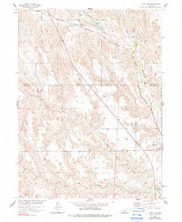
1956 Map of Curtis NW
USGS Topo · Published 1990About this map
Medicine Creek and its complex network of tributaries carve through this portion of Frontier and Lincoln Counties, defining a landscape of sharp ridges and deep draws. The Chicago Burlington And Quincy railroad line serves as a primary transit corridor, cutting northwest through the terrain toward the settlement of Wellfleet. The drainage patterns here are particularly intricate, with Lake Canyon and Buchanan Canyon feeding into the main valley, while further south, the bifurcated flow of North Brushy Creek and South Brushy Creek converge. On the eastern edge of the survey, the village of Maywood sits near the rail line, representing a small but vital hub for the surrounding ranching or farming community. A Gaging Station on Brushy Cr indicates the importance of water management in this part of the Missouri River Basin during the mid-century era.
Find a feature on this map
17 named features on this map. Tap any name to fly to it.
Don’t see what you’re looking for? This feature index may not catch every label — zoom into the map to look around manually.
Map Details
Editions of this 1956 Curtis NW Map
3 editions found
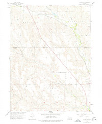
Other maps of this area

1954 · McCook
USGS Topo · 1:250,000

1956 · White NE
USGS Topo · 1:24,000

1956 · Curtis SW
USGS Topo · 1:24,000

1956 · Curtis NW
USGS Topo · 1:24,000

1956 · Curtis
USGS Topo · 1:24,000

1956 · Somerset
USGS Topo · 1:24,000

1956 · Curtis SE
USGS Topo · 1:24,000

1956 · Wellfleet SE
USGS Topo · 1:24,000

1956 · Wellfleet
USGS Topo · 1:24,000

1957 · McCook
USGS Topo · 1:250,000