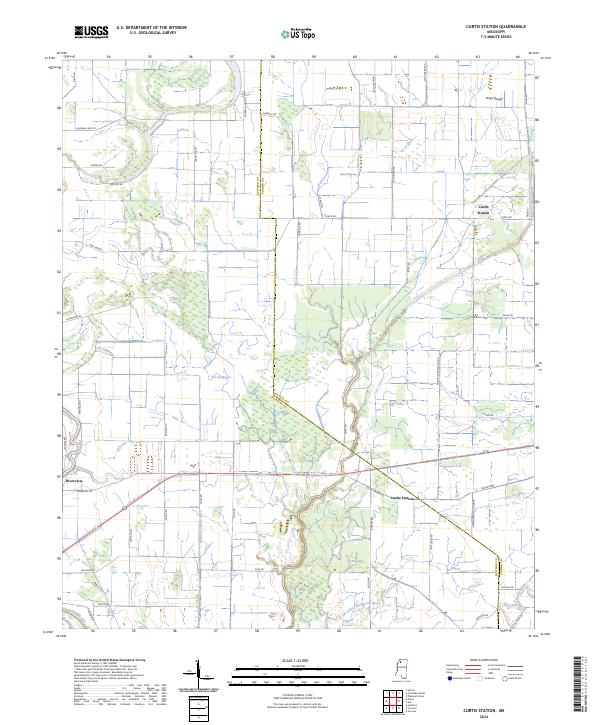
2024 Map of Curtis Station
USGS Topo · Published 2024About this map
Curtis Station and Locke Station anchor a landscape defined by complex water management and the alluvial heritage of the Mississippi Delta. The terrain is marked by an intricate network of natural and engineered waterways, including Viney Rough, Sand Bayou, and the artificial Quitman Panola Ditch, which redirect flow across the flat lands between the Coldwater River and the Tallahatchie River. This modern survey reveals how drainage systems and road networks, such as Curtis Locke Station Rd and Ash Logging Rd, have shaped the rural communities of Riverview and Old Little. The presence of the Old Little Tallahatchie River illustrates the shifting nature of these delta forks, providing a detailed perspective on the region's agricultural layout and civil boundaries along the Quitman and Panola county line.
Find a feature on this map
57 named features on this map. Tap any name to fly to it.
Don’t see what you’re looking for? This feature index may not catch every label — zoom into the map to look around manually.
Map Details
Editions of this 2024 Curtis Station Map
This is the sole edition of this map. No revisions or reprints were ever made.
Other maps of this area

1932 · Sledge
USGS Topo · 1:48,000

1932 · Tutwiler
USGS Topo · 1:48,000

1932 · Marks
USGS Topo · 1:48,000

1935 · Crowder
USGS Topo · 1:62,500

1935 · Marks
USGS Topo · 1:62,500

1935 · Tutwiler
USGS Topo · 1:62,500

1935 · Sledge
USGS Topo · 1:62,500

1939 · Sledge
USGS Topo · 1:62,500

1939 · Crowder
USGS Topo · 1:62,500

1939 · Tutwiler
USGS Topo · 1:62,500