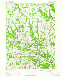
1953 Map of Curtisville
USGS Topo · Published 1965About this map
The Bessemer and Lake Erie railroad cuts a north-south path through this portion of Allegheny and Butler counties, anchoring the industrial and social landscape of the early 1950s. While small settlements like Curtisville and Culmerville show clustered residential growth, the surrounding hills are defined by extensive extraction activities, including a strip mine and several numbered shafts such as Mine No 2. A unique academic footprint is visible at the Carnegie Institute of Technology (Research Center) near Saxonburg.
Find a feature on this map
53 named features on this map. Tap any name to fly to it.
Don’t see what you’re looking for? This feature index may not catch every label — zoom into the map to look around manually.
Map Details
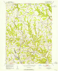
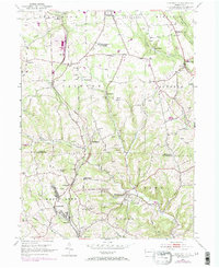
Editions of this 1953 Curtisville Map
Other maps of this area

1900 · Kittanning
USGS Topo · 1:62,500

1902 · Kittanning
USGS Topo · 1:62,500

1907 · Freeport
USGS Topo · 1:62,500

1908 · New Kensington
USGS Topo · 1:62,500

1909 · Freeport
USGS Topo · 1:62,500

1909 · Butler
USGS Topo · 1:62,500

1910 · New Kensington
USGS Topo · 1:62,500

1911 · Butler
USGS Topo · 1:62,500

1950 · Valencia
USGS Topo · 1:24,000

1953 · Pittsburgh
USGS Topo · 1:250,000
Featured Places
- Clinton Township, PA
- Red Hot, West Deer Township
- Buffalo Township, PA
- Winfield Township, PA
- Jefferson Township, PA