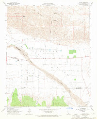
1964 Map of Cuyama
USGS Topo · Published 1965About this map
The Cuyama Valley floor is defined by an extensive network of water infrastructure and agricultural development in the mid-1960s. The settlement of Cuyama serves as a central hub, surrounded by a landscape marked by numerous wells and specialized routes like Kirchenmann Road and Schaefer Road. A distinctive cultural layer is noted in the valley with the mention of the (Heirs of Cesario Lataillade), indicating legacy land interests within the broader Grant Boundary. To the north, the arid peaks of the Caliente Range rise sharply, dissected by Quail Canyon and holding isolated water sources such as Willow Spring and the Quail Spring Reservoir. To the south, the terrain transitions into a series of deep drainages including Olive Canyon, Goode Canyon, and Tennison Canyon, where the dry bed of the Cuyama River and The Wash dictate the movement of roads and property lines across the Santa Barbara and San Luis Obispo county borders.
Find a feature on this map
26 named features on this map. Tap any name to fly to it.
Don’t see what you’re looking for? This feature index may not catch every label — zoom into the map to look around manually.
Map Details
Editions of this 1964 Cuyama Map
3 editions found
Other maps of this area

1902 · Santa Ynez
USGS Topo · 1:125,000

1903 · Mt. Pinos
USGS Topo · 1:125,000

1905 · Santa Ynez
USGS Topo · 1:125,000

1910 · Buena Vista Lake
USGS Topo · 1:125,000

1912 · McKittrick
USGS Topo · 1:125,000

1912 · Buena Vista Lake
USGS Topo · 1:125,000

1942 · Ballinger Canyon
USGS Topo · 1:24,000

1942 · East of Cuyama Ranch
USGS Topo · 1:24,000

1943 · Maricopa
USGS Topo · 1:31,680

1943 · Cuyama Ranch
USGS Topo · 1:31,680