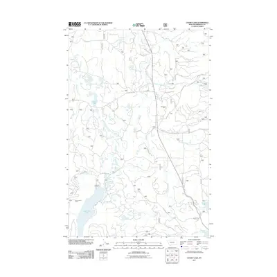
2011 Map of Cygnet Lake
USGS Topo · Published 2011About this map
Cygnet Lake and the larger Lindbergh Lake anchor this 2011 survey of Missoula County, where the Swan River flows through a landscape defined by forest access roads and scattered private holdings. This modern topographic study captures the area's recreational and agricultural footprint, showing the Lindbergh Campground and the Elbow Lookout Tower positioned for high-elevation oversight. The presence of the Hultman 33 Ranch and Gordon Ranch indicates the persistence of legacy ranching operations amidst the glacial waters of Stoner Lake and Loon Lake. Local travel is documented through a network of naming-rich routes including Kraft Creek Rd, Waldbillig Rd, and the Colt-Beaver Cutoff. This map is particularly valuable for tracing modern property boundaries and recreational access points before newer developments altered the surrounding wilderness interface.
Find a feature on this map
34 named features on this map. Tap any name to fly to it.
Don’t see what you’re looking for? This feature index may not catch every label — zoom into the map to look around manually.
Map Details
Editions of this 2011 Cygnet Lake Map
This is the sole edition of this map. No revisions or reprints were ever made.
Other maps of this area

1921 · Elbow Lake
USGS Topo · 1:125,000

1955 · Choteau
USGS Topo · 1:250,000

1957 · Choteau
USGS Topo · 1:250,000

1958 · Choteau
USGS Topo · 1:250,000

1962 · Choteau
USGS Topo · 1:250,000

1965 · Peck Lake
USGS Topo · 1:24,000

1965 · Condon
USGS Topo · 1:24,000

1965 · Holland Lake
USGS Topo · 1:24,000

1965 · Gray Wolf Lake
USGS Topo · 1:24,000

1965 · Lake Marshall
USGS Topo · 1:24,000