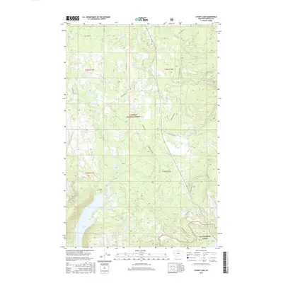
2017 Map of Cygnet Lake
USGS Topo · Published 2017About this map
Cygnet Lake and the sprawling waters of Lindbergh Lake define this high-altitude landscape where the Flathead National Forest meets the Lolo National Forest. The drainage patterns here are complex, with the Swan River and several major tributaries like Glacier Cr, Barber Cr, and Beaver Cr cutting through the terrain. The presence of Holland Peak anchors the topography, overseeing a network of forest access roads including Kraft Creek Rd and Lindbergh Lake Rd. This 2017 survey illustrates the intersection of these two massive national forests, showing the modern management of these timberlands and the preserved access to remote recreational waters. Local history and geography enthusiasts can trace the old road alignments such as Elk Creek Rd and Owl Creek Loop Rd that have long connected these lake basins.
Find a feature on this map
26 named features on this map. Tap any name to fly to it.
Don’t see what you’re looking for? This feature index may not catch every label — zoom into the map to look around manually.
Map Details
Editions of this 2017 Cygnet Lake Map
This is the sole edition of this map. No revisions or reprints were ever made.
Other maps of this area

1921 · Elbow Lake
USGS Topo · 1:125,000

1955 · Choteau
USGS Topo · 1:250,000

1957 · Choteau
USGS Topo · 1:250,000

1958 · Choteau
USGS Topo · 1:250,000

1962 · Choteau
USGS Topo · 1:250,000

1965 · Peck Lake
USGS Topo · 1:24,000

1965 · Condon
USGS Topo · 1:24,000

1965 · Holland Lake
USGS Topo · 1:24,000

1965 · Gray Wolf Lake
USGS Topo · 1:24,000

1965 · Lake Marshall
USGS Topo · 1:24,000