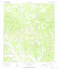
1964 Map of Cypress Creek
USGS Topo · Published 1975About this map
The hills of Kerr and Kendall counties in the mid-1960s were defined by a landscape of isolated springs and family-named ranching operations. Ranching life is documented through features like Crosscreek Ranch, Hasenwinkel Ranch, and Turkey Hollow Ranch, showing the spread of settlement across the dissected terrain. A complex network of water sources supported these holdings, including the evocatively named Dipping Vat Spring, Bear Creek Spring, and Whiskey Spring. Notable elevations like Rattlesnake Mountain, Pointed Mountain, and the No Name Hills provide landmark orientation. The map also captures the local geography of the upper Cypress Creek drainage, where small-scale extraction is noted at several Gravel Pit and Quarry locations along the county line.
Find a feature on this map
27 named features on this map. Tap any name to fly to it.
Don’t see what you’re looking for? This feature index may not catch every label — zoom into the map to look around manually.
Map Details
Editions of this 1964 Cypress Creek Map
3 editions found
Other maps of this area

1894 · Fredericksburg
USGS Topo · 1:125,000

1894 · Kerrville
USGS Topo · 1:125,000

1954 · Llano
USGS Topo · 1:250,000

1954 · San Antonio
USGS Topo · 1:250,000

1955 · Llano
USGS Topo · 1:250,000

1956 · Comfort
USGS Topo · 1:62,500

1956 · Center Point
USGS Topo · 1:62,500

1956 · Llano
USGS Topo · 1:250,000

1957 · San Antonio
USGS Topo · 1:250,000

1963 · Cain City
USGS Topo · 1:24,000