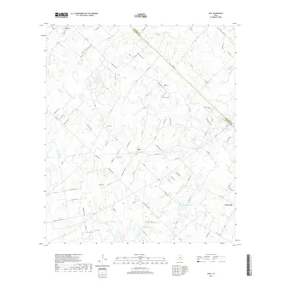
2019 Map of Dale
USGS Topo · Published 2019About this map
The settlement of Dale serves as the central hub of this Central Texas landscape, situated along the border of Bastrop and Caldwell counties. This region is defined by a complex network of small waterways, including Walnut Cr, Brushy Cr, and Haggai Cr, which carve through the terrain near Pool Hollow. For those researching local heritage, the map is remarkably dense with family and community burial sites, featuring the Saint John Cem, Bunton Cem, and Lytton Springs Cem among many others. The rural character of the area is further evidenced by landmarks like the Soil Conservation Service Site 24 Reservoir and the community of Taylorsville in the southeast. Transportation is anchored by several Farm-to-Market roads, such as FM 1854 and FM 20, which link these dispersed rural homesteads and agricultural tracts across the rolling prairie and creek bottoms.
Find a feature on this map
104 named features on this map. Tap any name to fly to it.
Don’t see what you’re looking for? This feature index may not catch every label — zoom into the map to look around manually.
Map Details
Editions of this 2019 Dale Map
This is the sole edition of this map. No revisions or reprints were ever made.
Other maps of this area

1885 · Bastrop
USGS Topo · 1:125,000

1893 · Bastrop
USGS Topo · 1:125,000

1896 · Austin
USGS Topo · 1:125,000

1897 · Austin
USGS Topo · 1:125,000

1901 · Flatonia
USGS Topo · 1:125,000

1904 · Bastrop
USGS Topo · 1:125,000

1910 · Austin
USGS Topo · 1:125,000

1911 · San Marcos
USGS Topo · 1:125,000

1919 · San Marcos
USGS Topo · 1:125,000

1925 · San Marcos 1-d
USGS Topo · 1:48,000