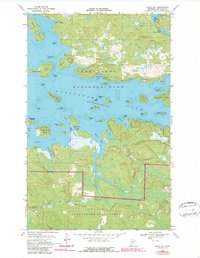
1968 Map of Daley Bay
USGS Topo · Published 1987About this map
Voyageurs National Park and the Kabetogama State Forest dominate this landscape, preserving a wilderness of interconnected waterways and island chains. The transition from the late 1960s to the 1980s is captured here, showing the intricate shoreline of Kabetogama Lake with its numerous named features like Nashata Point and Sugarbush Island. These waters, once critical for the fur trade, are represented at a normal reservoir pool elevation of 1119 feet.
Find a feature on this map
50 named features on this map. Tap any name to fly to it.
Don’t see what you’re looking for? This feature index may not catch every label — zoom into the map to look around manually.
Map Details
Editions of this 1968 Daley Bay Map
3 editions found
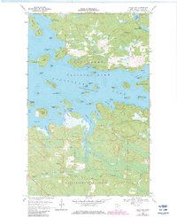
Other maps of this area

1954 · International Falls
USGS Topo · 1:250,000

1957 · International Falls
USGS Topo · 1:250,000

1958 · International Falls
USGS Topo · 1:250,000

1967 · Kempton Bay
USGS Topo · 1:24,000

1968 · Soldier Point
USGS Topo · 1:24,000

1968 · Daley Bay
USGS Topo · 1:24,000

1968 · Ash River SE
USGS Topo · 1:24,000

1968 · Ash River NE
USGS Topo · 1:24,000

1968 · Ash River SW
USGS Topo · 1:24,000

1969 · Ray SE
USGS Topo · 1:24,000