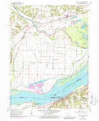
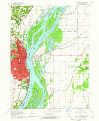
1964 Map of Dallas City
USGS Topo · Published 1986About this map
Mississippi River frontage and the low-lying bottomlands of the Skunk River define this riverine landscape at the border of Iowa and Illinois. The Illinois side is anchored by Dallas City and Pontoosuc, where the Atchison Topeka and Santa Fe railroad runs parallel to the water. In the northern reaches of the map, the Iowa countryside in Union and Green Bay townships is dotted with small-scale family landmarks, including Beebe Cem, Mohnike Cem, and the Eureka Sch.
Find a feature on this map
54 named features on this map. Tap any name to fly to it.
Don’t see what you’re looking for? This feature index may not catch every label — zoom into the map to look around manually.
Map Details
Editions of this 1964 Dallas City Map
4 editions found
Other maps of this area

1932 · Lomax
USGS Topo · 1:62,500

1934 · Burlington
USGS Topo · 1:48,000

1936 · Fort Madison
USGS Topo · 1:62,500

1937 · Lomax
USGS Topo · 1:62,500

1940 · Burlington
USGS Topo · 1:62,500

1958 · Burlington
USGS Topo · 1:250,000

1961 · Burlington
USGS Topo · 1:250,000

1963 · Burlington
USGS Topo · 1:250,000
1964 · Burlington
USGS Topo · 1:24,000

1964 · Lomax
USGS Topo · 1:24,000