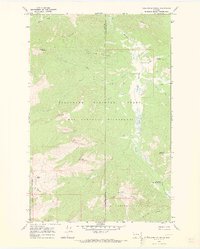
1970 Map of Danaher Mountain
USGS Topo · Published 1973About this map
Danaher Meadows forms a prominent natural opening in the dense forest canopy of the western Rockies, as documented in this 1970 field check. The landscape is defined by the intersection of the Flathead National Forest, Bob Marshall Wilderness, and Lolo National Forest. The remote Danaher Guard Station serves as the primary human landmark in a terrain otherwise dominated by high peaks like Alloy Mountain and Apex Mountain. A network of pack trails facilitates movement through the mountain passes, including the significant Limestone Pass. The drainage patterns are intricate, with Danaher Creek receiving numerous tributaries such as Foolhen Creek and White Creek. This map illustrates the primitive infrastructure of the early 1970s wilderness, where administrative boundaries and pack routes were the only signs of management in a vast protected area.
Find a feature on this map
34 named features on this map. Tap any name to fly to it.
Don’t see what you’re looking for? This feature index may not catch every label — zoom into the map to look around manually.
Map Details
Editions of this 1970 Danaher Mountain Map
2 editions found
Other maps of this area

1902 · Ovando
USGS Topo · 1:125,000

1903 · Coopers Lake
USGS Topo · 1:125,000

1905 · Ovando
USGS Topo · 1:125,000

1955 · Choteau
USGS Topo · 1:250,000

1957 · Choteau
USGS Topo · 1:250,000

1958 · Choteau
USGS Topo · 1:250,000

1962 · Choteau
USGS Topo · 1:250,000

1968 · Spread Mountain
USGS Topo · 1:24,000

1968 · Dunham Point
USGS Topo · 1:24,000
1968 · Lake Mountain
USGS Topo · 1:24,000