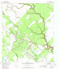
1952 Map of Danciger
USGS Topo · Published 1981About this map
The Bernard River defines the eastern edge of this coastal prairie landscape, where the settlement of Danciger sits at the heart of an active industrial and agricultural corridor. The map reveals a complex water management system necessary for this low-lying region, featuring a prominent Levee system and the Salt Water Canal cutting across the terrain. Oil and gas extraction are central to the area's mid-century identity, dominated by the sprawling Pledger Gas Field and a network of Pipe Lines that crisscross the bayous.
Find a feature on this map
35 named features on this map. Tap any name to fly to it.
Don’t see what you’re looking for? This feature index may not catch every label — zoom into the map to look around manually.
Map Details
Editions of this 1952 Danciger Map
3 editions found
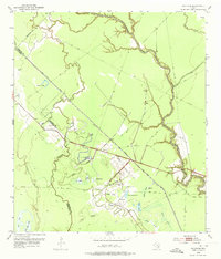
Other maps of this area

1950 · Houston
USGS Topo · 1:250,000

1952 · West Columbia
USGS Topo · 1:24,000

1952 · Sweeny
USGS Topo · 1:24,000

1952 · Danciger
USGS Topo · 1:24,000

1952 · Ashwood
USGS Topo · 1:24,000

1952 · Pledger
USGS Topo · 1:24,000

1952 · Van Vleck
USGS Topo · 1:24,000

1953 · Guy
USGS Topo · 1:24,000

1953 · Damon
USGS Topo · 1:24,000

1953 · Boling
USGS Topo · 1:24,000