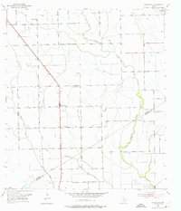
1951 Map of Danevang
USGS Topo · Published 1976About this map
Danevang serves as the central hub of this agricultural and industrial landscape along the Wharton Co Matagorda Co line in the early 1950s. The region is defined by its water management and resource extraction, featuring extensive engineering works like the Spoil Bank and Levee systems that flank the Tres Palacios River. Community life is anchored by several rural institutions, including Liberty Sch, Danevang Sch, and churches like New Bether Ch and Danevang Ch.
Find a feature on this map
15 named features on this map. Tap any name to fly to it.
Don’t see what you’re looking for? This feature index may not catch every label — zoom into the map to look around manually.
Map Details
Editions of this 1951 Danevang Map
2 editions found
Other maps of this area

1951 · Danevang
USGS Topo · 1:24,000

1952 · Lane City SE
USGS Topo · 1:24,000

1952 · Markham
USGS Topo · 1:24,000

1952 · Francitas NE
USGS Topo · 1:24,000

1952 · Lane City
USGS Topo · 1:24,000

1952 · Midfield
USGS Topo · 1:24,000

1952 · Pierce
USGS Topo · 1:24,000

1953 · Beeville
USGS Topo · 1:250,000

1953 · Seguin
USGS Topo · 1:250,000

1956 · Beeville
USGS Topo · 1:250,000