
1951 Map of Daniels Chapel
USGS Topo · Published 1952About this map
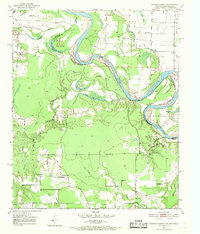
The Red River creates a meandering border between Texas and Arkansas on this 1951 survey, defining a landscape of active watercourses and shifting landmasses. The river's serpentine path is marked by features like Gano Island and Paul Moore Island, where an indefinite boundary reflects the naturally changing channel. On the Texas side, the settlement of Daniels Chapel and the community at Woodstock anchor a rural interior drained by Mud Creek and Daniels Creek. This area is particularly rich in genealogy markers, featuring several country churches including Pleasant Hill Ch and New Zion Ch. The presence of Lewis Ferry across the Red River highlights the era's reliance on river crossings for regional transit. In the north, the small settlement of Almont is documented with its local school, Almont Sch, and the nearby Macedonia Ch, providing a detailed look at the social centers of this river-valley community.
Find a feature on this map
36 named features on this map. Tap any name to fly to it.
Don’t see what you’re looking for? This feature index may not catch every label — zoom into the map to look around manually.
Map Details
Editions of this 1951 Daniels Chapel Map
4 editions found
Other maps of this area

1909 · New Boston
USGS Topo · 1:62,500

1930 · Bassett
USGS Topo · 1:62,500

1950 · Redbank
USGS Topo · 1:24,000

1950 · Tom
USGS Topo · 1:24,000

1950 · De Kalb
USGS Topo · 1:24,000

1951 · De Kalb
USGS Topo · 1:24,000

1951 · Tom
USGS Topo · 1:24,000

1951 · Redbank
USGS Topo · 1:24,000

1951 · Arden
USGS Topo · 1:24,000

1951 · Foreman
USGS Topo · 1:24,000