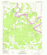
1951 Map of Daniels Chapel
USGS Topo · Published 1976About this map
Red River meanders define the border between Texas and Arkansas in this mid-century portrait of a riverine landscape. The shifting nature of the waterway is evident in features like Hurricane Bend Lake and Gano Island, while the surrounding bottomlands are threaded with bayous and creeks including Hooks Bayou and Mud Creek. This survey captures the rural character of Bowie County before more modern development, centered on small crossroads like Woodstock and Daniels Chapel.
Find a feature on this map
31 named features on this map. Tap any name to fly to it.
Don’t see what you’re looking for? This feature index may not catch every label — zoom into the map to look around manually.
Map Details
Editions of this 1951 Daniels Chapel Map
4 editions found

Other maps of this area

1909 · New Boston
USGS Topo · 1:62,500

1930 · Bassett
USGS Topo · 1:62,500

1950 · Redbank
USGS Topo · 1:24,000

1950 · Tom
USGS Topo · 1:24,000

1950 · De Kalb
USGS Topo · 1:24,000

1951 · De Kalb
USGS Topo · 1:24,000

1951 · Tom
USGS Topo · 1:24,000

1951 · Redbank
USGS Topo · 1:24,000

1951 · Arden
USGS Topo · 1:24,000

1951 · Foreman
USGS Topo · 1:24,000