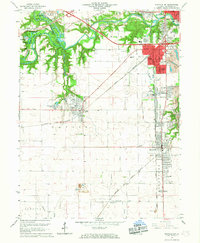
1966 Map of Danville SW
USGS Topo · Published 1967About this map
Kickapoo State Park and the rugged basins of the Salt Fork River anchor the northwestern portion of this mid-1960s survey, illustrating a landscape deeply defined by surface excavation and post-mining reclamation. The terrain is characterized by a dense network of water bodies like Mission Field Pond and Doughnut Pond, which sit adjacent to numerous Mine Dumps and active operations such as the Deep Valley Mine. This industrial legacy is contrasted by the residential growth extending from Danville into South Danville and Tilton, where the Norfolk and Western and Chicago and Eastern Illinois railroads facilitated the movement of coal and freight.
Find a feature on this map
69 named features on this map. Tap any name to fly to it.
Don’t see what you’re looking for? This feature index may not catch every label — zoom into the map to look around manually.
Map Details
Editions of this 1966 Danville SW Map
2 editions found
Other maps of this area

1899 · Danville
USGS Topo · 1:62,500

1900 · Danville
USGS Topo · 1:62,500

1931 · Fithian
USGS Topo · 1:48,000

1943 · Fithian
USGS Topo · 1:62,500

1947 · Ridge Farm
USGS Topo · 1:62,500

1948 · Danville NW
USGS Topo · 1:24,000

1949 · Danville SW
USGS Topo · 1:24,000

1950 · Danville SW
USGS Topo · 1:24,000

1950 · Danville NW
USGS Topo · 1:24,000

1950 · Danville SE
USGS Topo · 1:24,000