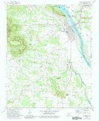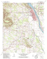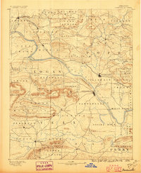
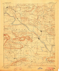
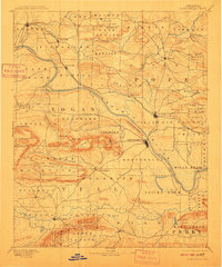
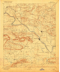
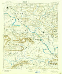
1890 Map of Dardanelle
USGS Topo · Published 1896About this map
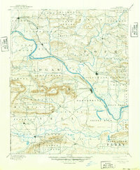
The Arkansas River serves as the central artery for this late nineteenth-century landscape, dividing the river valley into a network of ferry crossings and riparian settlements. The L. R. & F. S. R. R. railroad corridor parallels the northern bank, fueling the growth of Russellville and Clarksville while bypassing older riverside landings like Dardanelle. Inland, the terrain is defined by prominent ridges such as Chickalah Mountain and Buck Mountain, which dictated the early road patterns connecting isolated communities like Lutherville and Scottsville. To the south, the Petit Jean River meanders through the flats near Danville, where family-named landmarks like Bunker Hill and Lee Mt. provided orientation for early settlers. The map documents a period when rural post offices and small townships like Shoal Creek and Chickalah were the primary social centers for the surrounding farming and timber districts.
Find a feature on this map
90 named features on this map. Tap any name to fly to it.
Don’t see what you’re looking for? This feature index may not catch every label — zoom into the map to look around manually.
Map Details
Editions of this 1890 Dardanelle Map
7 editions found

Historical Maps of Russellville Through Time
8 maps found