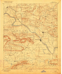
1890 Map of Dardanelle
USGS Topo · Published 1916About this map
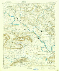
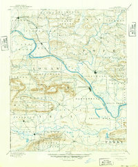
The Arkansas River serves as the primary artery for this late nineteenth-century landscape, winding between the river towns of Dardanelle and Russellville. To the north, the geography is defined by the steep elevation of Sand Mountain and Buck Mountain, while the southern portion features the prominent heights of Huckleberry Mountain and Chickalah Mountain. This survey, conducted by H.B. Blair in 1888, captures a network of small agricultural and mining communities like Lutherville, Knoxville, and Dover. A notable topographic landmark, Mt. Nebo, overlooks the river valley near Dardanelle, illustrating the region's varied terrain. The map also details the complex hydrology of the area, including Illinois Bayou, Big Piney Cr., and the expansive Holly Bend area, providing a clear record of the early county divisions between Johnson, Pope, Logan, and Yell.
Find a feature on this map
83 named features on this map. Tap any name to fly to it.
Don’t see what you’re looking for? This feature index may not catch every label — zoom into the map to look around manually.
Map Details
Editions of this 1890 Dardanelle Map
7 editions found

Other maps of this area

1879 · Mountain Home
USGS Topo · 1:62,500

1879 · Washington
USGS Topo · 1:62,500

1887 · Magazine Mountain #1
USGS Topo · 1:62,500

1887 · Smyrna
USGS Topo · 1:62,500

1887 · Magazine Mountain #4
USGS Topo · 1:62,500

1887 · Magazine Mountain
USGS Topo · 1:62,500

1888 · Dardanelle #4
USGS Topo · 1:62,500

1888 · Dardanelle #2
USGS Topo · 1:62,500

1888 · Dardanelle #1
USGS Topo · 1:62,500

1888 · Dardanelle #3
USGS Topo · 1:62,500