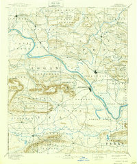
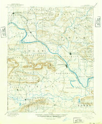
1890 Map of Dardanelle
USGS Topo · Published 1903About this map
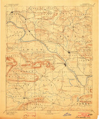
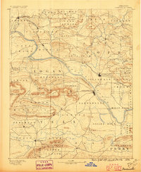
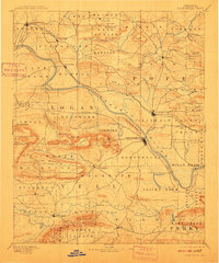
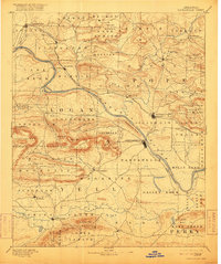
The Arkansas River carves a massive southeastward path through this 1888 survey, serving as the central artery for commerce between the Ozarks and the Ouachitas. Early riverside settlements like Dardanelle and Russellville stand as established hubs, while smaller mountain communities like Lutherville and Scottsville mark the northern uplands. The landscape is defined by significant ridges and peaks, including the prominent Mt Nebo and Huckleberry Mountain, which overlook a network of critical waterways such as Illinois Bayou and Big Piney Cr.
Find a feature on this map
86 named features on this map. Tap any name to fly to it.
Don’t see what you’re looking for? This feature index may not catch every label — zoom into the map to look around manually.
Map Details
Editions of this 1890 Dardanelle Map
7 editions found

Other maps of this area

1879 · Mountain Home
USGS Topo · 1:62,500

1879 · Washington
USGS Topo · 1:62,500

1887 · Magazine Mountain #1
USGS Topo · 1:62,500

1887 · Smyrna
USGS Topo · 1:62,500

1887 · Magazine Mountain #4
USGS Topo · 1:62,500

1887 · Magazine Mountain
USGS Topo · 1:62,500

1888 · Dardanelle #4
USGS Topo · 1:62,500

1888 · Dardanelle #2
USGS Topo · 1:62,500

1888 · Dardanelle #1
USGS Topo · 1:62,500

1888 · Dardanelle #3
USGS Topo · 1:62,500