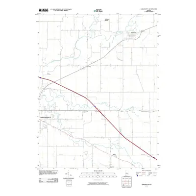
2010 Map of Darlington
USGS Topo · Published 2010About this map
Sugar Creek and its many branches, including Little Sugar Creek and Walnut Fork Sugar Creek, define the topography of this portion of Montgomery County. The settlement of Darlington is the primary hub in the north, situated near Honey Creek and the wooded terrain of Darlington Woods. This 2010 survey illustrates the modernization of the landscape with Interstate 74 cutting a diagonal path through the rural acreage, juxtaposing modern high-speed transit against the traditional grid of county roads. Smaller communities such as Garfield, Smartsburg, Mace, and Linnsburg remain established along the local thoroughfares. For those researching local families, the map identifies Greenlawn Cemetery and Hutton Cemetery, providing essential geographic context for ancestral homesteads near the eastern edge of Crawfordsville. The convergence of these waterways suggests a landscape that has long been shaped by the drainage patterns of the Central Till Plain.
Find a feature on this map
38 named features on this map. Tap any name to fly to it.
Don’t see what you’re looking for? This feature index may not catch every label — zoom into the map to look around manually.
Map Details
Editions of this 2010 Darlington Map
This is the sole edition of this map. No revisions or reprints were ever made.
Other maps of this area

1953 · Danville
USGS Topo · 1:250,000

1953 · Indianapolis
USGS Topo · 1:250,000

1955 · Danville
USGS Topo · 1:250,000

1956 · Danville
USGS Topo · 1:250,000

1956 · Indianapolis
USGS Topo · 1:250,000

1956 · Crawfordsville
USGS Topo · 1:24,000

1956 · New Market
USGS Topo · 1:24,000

1957 · Indianapolis
USGS Topo · 1:250,000

1957 · New Ross
USGS Topo · 1:24,000

1958 · Darlington
USGS Topo · 1:24,000